
NEWS
Rain Eases in North India as Monsoon Leaves Early
The southwest monsoon left Chandigarh two days early, a deep depression is crossing Myanmar rather than India, and 14 states remain short of seasonal rain.

Rain is due to ease across north India on Tuesday, 29 September, as the southwest monsoon holds an early withdrawal line through Chandigarh. A deep depression over the north Andaman Sea is taking aim at Myanmar instead, while Karnataka, Tamil Nadu and the Northeast stay under heavy-rain alerts.
The India Meteorological Department, in its Monday afternoon bulletin, still has isolated showers possible over Delhi, Haryana and Punjab on 29 September, then mainly dry weather over much of the northwest from 30 September. That dry belt is the season leaving, not a pause, and it arrives while 14 states are still short of rain.
Chandigarh Saw Its Earliest Exit Since 2001
The southwest monsoon withdrew from entire Delhi, most of Punjab, Haryana and Rajasthan, and parts of Uttar Pradesh and Gujarat on 23 September. IMD’s normal date for Delhi, drawn from 1971 to 2019, is 25 September, so the capital is two days early.
Surender Paul, director of IMD Chandigarh, said the city had not seen an earlier official retreat since 2001, when the monsoon left on 18 September, and he tied this year’s pace to El Niño.
In the previous years, we had seen that the withdrawal took place towards the end of September and sometimes even in October, but due to the effect of the El Nino system, monsoon has retreated relatively early.
Surender Paul, director, IMD Chandigarh
Withdrawal from west Rajasthan only began on 19 September, two days after the 17 September normal, then jumped southeast. By 21 September the line already cut through parts of Haryana and Punjab. IMD does not try a first withdrawal from the far northwest before 1 September, and it needs five dry days, drier air on satellite, and a continuous line before it moves the map again.
THE WITHDRAWAL LINE
- 19 September 2026: Southwest monsoon withdraws from west Rajasthan, two days after the 17 September normal.
- 21 September 2026: The line pushes through more of Rajasthan and parts of Haryana and Punjab.
- 23 September 2026: Most of Punjab, Haryana and Rajasthan, entire Delhi, and parts of Uttar Pradesh and Gujarat come out of the monsoon.
- 28 September 2026: The line still runs through Gurdaspur, Chandigarh, Muzaffarnagar, Aligarh, Dholpur, Udaipur, Deesa and Naliya.
That Chandigarh-to-Naliya arc has not jumped in five days because a western disturbance and leftover rain over the hills kept moisture in the north. A previous deep depression that crossed the Andhra-Odisha coast on 23 September had already slowed the retreat once, then weakened over Uttar Pradesh and became less marked by 5.30 am on 28 September.
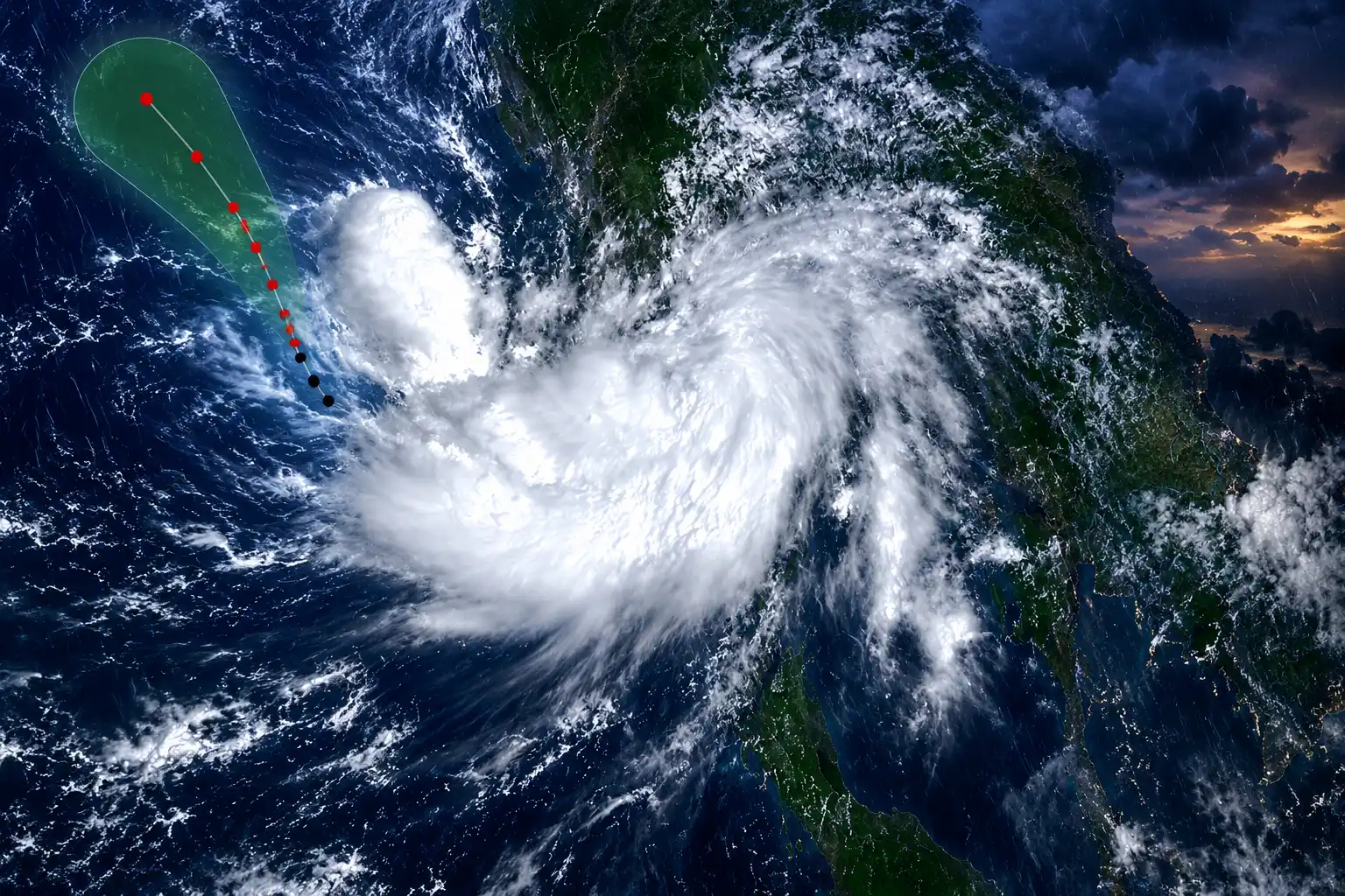
A Deep Depression Is Crossing Myanmar on 28 September
The live engine for the east is not a storm headed at Chennai or Puri. Yesterday’s well marked low over the north Andaman Sea became a depression at 5.30 am IST on 28 September, then a deep depression by 11.30 am, near 16.4°N and 97.3°E, about 40 km west-southwest of Mawlamyine and 610 km northeast of Mayabandar in the Andaman Islands.
IMD’s marine desk lists the storm warning for the system as nil, which means it is not expected to become a cyclonic storm. The same bulletin has it crossing the Myanmar coast between Yangon and Kyaikto around the evening of 28 September, then running north-northwest across coastal Myanmar toward southeast Bangladesh over two days, and fading to a well marked low by 11.30 am on 30 September.
The Depression over north Andaman Sea & adjoining Myanmar coast moved north-northwestwards with a speed of 10 kmph during past 3 hours, intensified into a deep depression and lay centred at 1130 hrs IST of today, the 28th September 2026 over the same region near latitude 16.4°N… pic.twitter.com/E53iXp3AxE
— India Meteorological Department (@Indiametdept) September 28, 2026
Myanmar’s Department of Meteorology and Hydrology, in a 4 pm local bulletin, said the system would cross Yangon Region and Mon State within six hours, with a centre pressure of 1,000 hPa and winds of 35 to 40 miles per hour, then continue over Bago and Magway. Coastal Odisha is not on that track. The Monday national bulletin keeps Odisha on isolated rain through 4 October with no heavy-rain warning, which is the whole point of a strike this far east: the cone stays near 97°E and does not loop toward the Indian east coast the way the 23 September system did.
FORECAST TRACK FROM 1130 IST
| Time (IST) | Centre | Sustained winds | Category |
|---|---|---|---|
| 28 Sep, 11.30 am | 16.4°N, 97.3°E | 50 to 60 kmph, gusts 70 | Deep depression |
| 28 Sep, 5.30 pm | 16.9°N, 97.1°E | 55 to 65 kmph, gusts 75 | Deep depression |
| 28 Sep, 11.30 pm | 17.4°N, 96.9°E | 50 to 60 kmph, gusts 70 | Deep depression |
| 29 Sep, 5.30 am | 17.9°N, 96.7°E | 45 to 55 kmph, gusts 65 | Depression |
| 30 Sep, 11.30 am | 20.9°N, 95.2°E | 30 to 40 kmph, gusts 50 | Well marked low |
Peak winds on that table arrive on the Myanmar coast, not over Indian land. What India still gets is squally weather over the Andaman Sea and leftover showers where a separate lower-level trough runs from North Interior Karnataka into Tamil Nadu.
Delhi, Punjab and Haryana Turn Drier on Tuesday
Northwest India is coming off a wet Monday, not a wet week. A western disturbance as a trough along 68°E, north of 25°N, plus an upper-air cyclonic circulation over northwest Uttar Pradesh, still favoured fairly widespread rain over Jammu and Kashmir and Uttarakhand on 28 September, with isolated heavy rain over Himachal Pradesh.
Delhi’s own Monday package was a generally cloudy sky, very light to light rain at many places, moderate rain at isolated places, thunderstorms, and surface winds of 30 to 40 kmph gusting to 50 kmph. Maximum temperatures were in the 28 to 30C range and well below normal. Chandigarh’s observatory logged a maximum of 30.5C, 1.4C below normal, and a minimum of 22.1C.
On 29 September IMD still allows isolated to scattered rain with thunder over Haryana, Chandigarh, Delhi, Punjab and west Uttar Pradesh. Meteorological Centre Chandigarh is more local: light to moderate rain at isolated places on Tuesday with no warning, then a dry day on 30 September with a 25C minimum and a 33C maximum. The national desk’s broader call is mainly dry weather over many parts of northwest India from 30 September, and over many parts of central India from 2 October.
Uttar Pradesh gets that drier window after a brutal burst. In the 24 hours ending 8.30 am on 28 September, Chandpur, Dhampur and Nagina in Bijnor each recorded 9 cm, Bijnor station 8 cm, and several stations in Amroha and Moradabad 7 cm. IMD has no heavy-rain warning for east or west Uttar Pradesh on 29 September. Isolated rain can still fall through 30 September in the east, but the system that soaked the state has already been marked less marked.
Where the Heavy Rain Warnings Still Stand
The rain that still matters on 29 September sits well south and east of the withdrawal line. IMD’s Monday release keeps isolated heavy rain over South Interior Karnataka from 29 September to 2 October, with fairly widespread to widespread falls from 29 September to 1 October, plus thunderstorms, lightning and gusty winds.
Tamil Nadu, Puducherry and Karaikal are in the same belt, with isolated heavy rain from 28 September to 1 October. Kerala and Mahe join on 30 September and stay under isolated heavy rain through 3 October, when the southwest monsoon is still allowed to cover the peninsula. IMD does not declare withdrawal from the southern peninsula, or from the country as a whole, before 1 October, and only after the winds flip out of the southwesterly regime.
RAIN ALERTS FOR 29 SEPTEMBER TO 2 OCTOBER
- South Interior Karnataka: Fairly widespread to widespread rain from 29 September to 1 October, with isolated heavy falls through 2 October and thunderstorms.
- Tamil Nadu, Puducherry and Karaikal: Isolated heavy rain from 28 September to 1 October, with lightning and gusty winds into 2 October.
- Kerala and Mahe: Isolated heavy rain from 30 September to 3 October; fairly widespread to widespread cover from 1 to 4 October.
- Nagaland, Manipur, Mizoram and Tripura: Isolated heavy rain on 29 and 30 September, with thunderstorms and lightning.
- Andaman and Nicobar Islands: Fairly widespread to widespread rain on 28 and 29 September, with thundersqualls of 50 to 60 kmph gusting to 70 kmph.
- Madhya Maharashtra and Konkan-Goa: Thunderstorms and lightning on 29 September, with gusty winds over the Konkan strip.
Assam and Meghalaya are also in the 29 and 30 September heavy-rain window. Arunachal Pradesh is listed later, around 3 October. Coastal Andhra Pradesh and Rayalaseema are on strong surface winds from 28 September to 2 October, which is a travel and fishing problem even without a heavy-rain colour on the map.
Fourteen States Remain Short of Seasonal Rain
The dry north can look like a finished monsoon on a forecast chart and still sit inside a patchy season. IMD’s hydromet sheet for seasonal rainfall through 28 September puts the country at 757 mm against a normal of 861.3 mm, a shortfall of 12% that still falls in the Normal band of minus 19% to plus 19%.
Break that national number by state and the holes open. Fourteen states are Deficient, covering 39% of India’s area, while 18 states on 53% of the area sit in Normal. East and northeast India as a block is 25% short. The south peninsula is 24% short. Northwest India is only 6% short, which is why a Normal label still attaches to the region even as Punjab’s grain belt is 42% down.
SEASONAL RAINFALL, 1 JUNE TO 28 SEPTEMBER
| State / region | Actual (mm) | Normal (mm) | Departure | Category |
|---|---|---|---|---|
| Punjab | 255.1 | 437.8 | -42% | Deficient |
| Haryana | 319.3 | 425 | -25% | Deficient |
| Chandigarh | 717.3 | 844.7 | -15% | Normal |
| Delhi | 565.8 | 542.9 | +4% | Normal |
| Uttar Pradesh | 805.2 | 742.2 | +8% | Normal |
| Karnataka | 570.6 | 819.9 | -30% | Deficient |
| Kerala | 1451.7 | 2001.1 | -27% | Deficient |
| Tamil Nadu | 256.1 | 318.5 | -20% | Deficient |
| Meghalaya | 1073.5 | 2671.8 | -60% | Large deficient |
| India | 757 | 861.3 | -12% | Normal |
Uttar Pradesh’s plus 8% is why a late flood burst can wreck districts inside a Normal season. Karnataka’s minus 30% is why three more days of heavy rain in the south interior still matter for reservoirs and standing crops. Meghalaya’s minus 60% Large Deficient mark is the starkest cell on the sheet, and isolated heavy rain over the Northeast on 29 and 30 September will not close a gap that large.
Squally Winds Close the Andaman Sea to Boats
The people who have to act on Monday night are on the water, not in Delhi. IMD has squally weather of 45 to 55 kmph gusting to 65 kmph already over the Andaman Sea, the Myanmar coast and the Andaman Islands, rising to 50 to 60 kmph gusting to 70 kmph by Monday afternoon and to 55 to 65 kmph gusting to 75 kmph from Monday evening through Tuesday evening.
Sea state is rough to very rough over the Andaman Sea and adjoining east-central Bay until the evening of 29 September, then along the Myanmar-Bangladesh coasts and the northeast Bay from 29 September to 1 October. The northern Bay forecast carries wave heights of 4.0 to 6.0 metres near the storm on 28 September, easing to 2.5 to 4.0 metres on 29 September. Haldia and Kolkata ports were on Distant Cautionary Signal No. 1, with a sectional signal at Sagar Island, even though West Bengal’s own coast has no fishermen warning.
Fishermen are advised not to venture into Andaman Sea and adjoining areas of southeast Bay of Bengal and along and off Myanmar coast till 28th September evening and along and off Myanmar coast and adjoining areas of Eastcentral Bay of Bengal from 28th evening to 30th September evening and along and off Bangladesh coast and adjoining areas of northeast Bay of Bengal during 29th September to 1st October, 2026.
India Meteorological Department, national press release, 28 September 2026
West Bengal’s marine desk repeated the same Bay ban for 29 and 30 September and added a swell-surge note of 1.1 to 1.2 m waves with 18 to 22 second periods into the night of 29 September. That is a boat-handling warning, not a cyclone landfall on the Indian mainland.
Uttarakhand’s 7 cm Bursts Ease to Isolated Showers
The hills are the last northern pocket still wringing out Monday’s rain. Purola and Barkot in Uttarkashi, and Keertinagar in Tehri Garhwal, each recorded 7 cm in the 24 hours ending 8.30 am on 28 September, matching Kangra airport in Himachal Pradesh at 7 cm. IMD classed those totals as heavy rain, the 7 to 11 cm band, and it had no heavy-rain warning left for Uttarakhand on Tuesday.
Light to moderate rain is still likely at a few places in Uttarkashi, Rudraprayag, Chamoli, Bageshwar and Pithoragarh on 29 September, with isolated to scattered showers possible in the state through 4 October. Himachal Pradesh is on isolated rain. Snow in the higher reaches in recent days is already in the rear-view; the next western disturbance is not due in the Monday bulletin until 2 to 4 October over Jammu and Kashmir.
The withdrawal line on 28 September still ran through Gurdaspur, Chandigarh, Muzaffarnagar, Aligarh, Dholpur, Udaipur, Deesa and Naliya. Further withdrawal from the southern peninsula, IMD says, is not declared before 1 October.

A CubeSat Will Age Whisky That Never Comes Home

A Charity Quote Cost Shia LaBeouf the FKA twigs NDA

Looker Turned a Model’s Body Into Ad Inventory

Infinity Ward Bets a Paid DMZ Will Stick This Time

Disney Sidesteps a Kimmel Renewal as Failla Cites Losses

How to Get Pre Boarding on Southwest – Skip the Line with These Tricks

False AI Intel Nearly Put US Crews on a Chinese Ship

Tim Cook’s $4.6 Trillion Apple Still Runs on One Phone

OpenAI Posts a Navier-Stokes Proof Clay Has Not Touched

Dunes Air Sues Nora Fatehi Over Its Luxury Jet
-
 TRAVEL3 years ago
How to Get Pre Boarding on Southwest – Skip the Line with These Tricks
-
 NEWS1 month ago
False AI Intel Nearly Put US Crews on a Chinese Ship
-
 BUSINESS2 months ago
Tim Cook’s $4.6 Trillion Apple Still Runs on One Phone
-
 NEWS2 months ago
OpenAI Posts a Navier-Stokes Proof Clay Has Not Touched
-
 ENTERTAINMENT2 months ago
Dunes Air Sues Nora Fatehi Over Its Luxury Jet
-

 LIFESTYLE3 years ago
How Often Do You Have to Change a Monkey’s Diaper? The Truth About Pet Monkeys
-

 NEWS2 months ago
Australia Treats Cloud Software Payments as Taxable Royalties
-

 LIFESTYLE3 years ago
How Long Does It Take for Armpit Hair to Grow? The Stages of Hair Growth and How to Shave It